
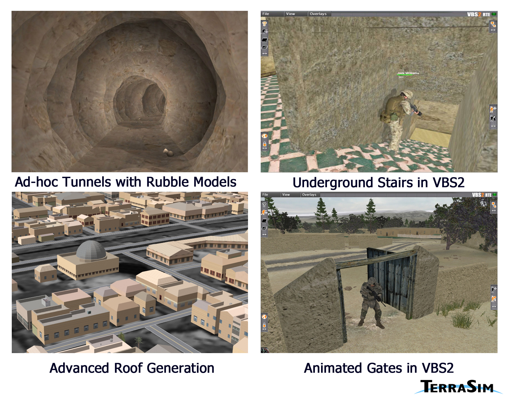
Virtual and constructive simulation programs have continued to focus on warfighter requirements for urban operations, including real world environments supporting live training. This image shows four aspects of Urban Details™ processing. All are in advanced development at TerraSim for future release in TerraTools® Core in support of these simulation systems.
When minimal geospatial source data is available, Urban Details technology intensifies the visual environment. Man made tunnels, both engineered and of ad hoc design, present challenges for automation given the general lack of detailed source data. The top, left figure shows an ad hoc tunnel generated from a set of linear segments. The top, right figure shows an engineered bunker with a staircase leading into the underground structure as represented in Virtual Battlespace 2 (VBS2). These structures can also exported to support UHRB (OneSAF), MES (OTBSAF), and Complex Buildings (JSAF).
The bottom, left figure shows a collection of advanced building roof models parametrically generated from simple 2D building footprints. Finally, the bottom, right figure illustrates the automated generation of gated apertures in a rural fence. Urban Details technology places user defined models within any aperture (door, window, wall). In the case of visual game environments, these apertures have the properties necessary to interact with players, including motion and real time destruction.
Questions or comments?
Send Email to The IMAGE Society
(IMAGE@IMAGE-Society.org).
Back to IMAGE Society Site Contents.
Copyright © 2009
The IMAGE Society, Inc.
All rights reserved.