
MetaVR recently built and delivered to the Naval Strike and Air Warfare Center (NSAWC) at Naval Air Station (NAS) Fallon, Nevada, high-resolution geospecific synthetic 3D terrain of two target ranges of the Fallon Range Training Complex (FRTC). This synthetic terrain will be used in the Combined Arms Virtual Environment (CAVE) training dome and desktop simulator systems for the NSAWC's Joint Terminal Attack Controller (JTAC) qualification course.
The 2 cm per pixel imagery used to build the virtual ranges was captured over the course of 5 days by MetaVR's portable UAV, MetaVRC. The portable UAV was built and flown by Swift Radioplanes in military controlled air space. With both the imagery and NED 10 meter elevation data, MetaVR compiled full-resolution (2 cm) terrain tiles of the ranges with MetaVR Terrain Tools for Esri ArcGIS. The total area of virtual terrain coverage is 65.81 sq km.
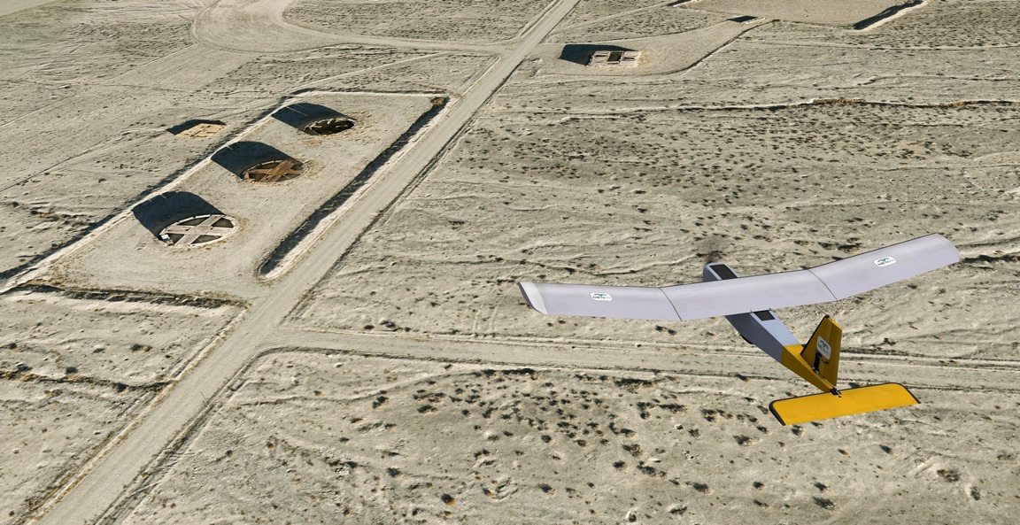
This image shows a dynamic model of the MetaVRC in flight over a detail of the synthetic terrain. At 2 cm resolution, details such as helicopter landing areas, bullet-ridden vehicle targets, scrub grass, and small craters left from exploded ordnance are visible on the terrain when it is rendered in MetaVR's Virtual Reality Scene Generator (VRSG) at 60 Hz. This level of detail is important because the virtual terrain is used for simulation training by students prior to field training on the actual ranges. In a close air support exercise conducted on the CAVE simulators, the virtual range rendered in VRSG must resemble the actual range as close as possible to the student in the JTAC observation post.
The virtual terrain is part of MetaVR's terrain of Continental US plus Alaska and Hawaii (CONUS++) and is available to MetaVR customers on active software maintenance.
Copyright © 2015
The IMAGE Society, Inc.
All rights reserved.