May 2019
IMAGE OF THE MONTH


courtesy of

MetaVR
An Associate Member
of the
IMAGE Society


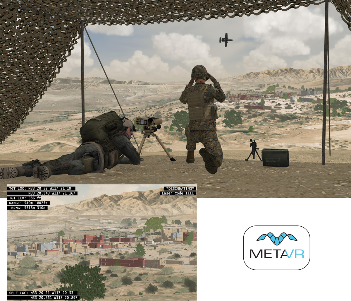
Click here to see the full size screenshot
The full size screenshot from MetaVR Virtual Reality Scene Generator
taken on a 4K monitor at 3840 x 2160 pixel resolution.


MetaVR's Virtual Camp Pendleton

The main image is a scene from MetaVR's Virtual Reality Scene GeneratorTM (VRSGTM) with two joint terminal attack controller (JTAC) characters overlooking the modeled Kilo 2 training site on the company's virtual high-resolution geospecific terrain of Marine Corps Base Camp Pendleton, CA. The screen capture was taken on a 4K monitor at the full-size resolution of 3840 x 2160 pixels and is unaltered.
The inset image illustrates VRSG's integration with simulated military equipment and its ability to simulate a laser mark and designate for laser-guided munitions.  
The 24 sq km virtual terrain of Camp Pendleton was built in our round-earth MetadesicTM terrain format with MetaVR Terrain Tools for Esri  ArcGIS  from 30 cm per-pixel resolution USGS satellite imagery and 60 cm LIDAR elevation data blended to 10 meter NED, and geometric water shoreline. The virtual Combat Town 25 and Kilo 2 training sites feature substantial 3D content created from publicly available photos and videos and then geolocated on the terrain in VRSG Scenario Editor. This virtual Camp Pendleton is one of several modeled training sites within MetaVR's terrain of the USA.   
The 3D terrain is used for training in the U.S. Navy Combined Arms Virtual Environment (CAVE) simulator at the Expeditionary Warfare Training Group, Pacific (EWTGPAC) facility at Naval Amphibious Base, Coronado, CA. Prior to training on the live range at Camp Pendleton, students practice on the simulator the tasks, techniques, and procedures they'll use on the range.  
This real-time VRSG scene is running at 60 Hz with a 60-degree field-of-view and a 100 km far horizon. The characters and culture models are from MetaVR's 3D content libraries. This image also shows object-on-object self-shadowing according to the sun orientation, a feature found in the forthcoming release of VRSG version 6.4.  
VRSG is a real-time 3D image generator that provides the fidelity of geospecific simulation with game quality graphics. With real-world data, users can build high-performance virtual worlds with MetaVR's round-earth terrain generation tools and render them at 60Hz frame rates in VRSG.   
 
For more information contact:

W. Garth Smith
President & Co-Founder
MetaVR, Inc.
80 Somerset Road
Brookline, MA 02445
Tel: 617-739-2667
Email: wgsmith@metavr.com
Web Site: http://www.metavr.com
 
MetaVR and the MetaVR logo are registered trademarks and Virtual Reality Scene Generator, VRSG, and Metadesic are trademarks of MetaVR, Inc. ArcGIS and Esri are registered trademarks of Esri.


Instructions to Submit your JPEG/GIF file for Image of the Month


Copyright   2019

The IMAGE Society, Inc.
All rights reserved.